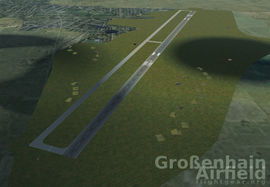
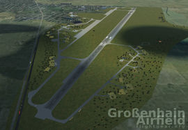
Grossenhain Airfield
 Grossenhain Airfield via Terrasync | ||||||||||
 Grossenhain Airfield via Add-on | ||||||||||
| ||||||||||
| Type | Public | |||||||||
|---|---|---|---|---|---|---|---|---|---|---|
| Owner | Flugplatz Grossenhain UG | |||||||||
| City | Grossenhain | |||||||||
| website | ||||||||||
| ||||||||||
| Scenery tile | e010n050 | |||||||||
| TerraSync | published | |||||||||
| Download | ||||||||||
The Grossenhain Airfield is one of the oldest operating airfields in Germany and a symbol of the aeronautical tradition of the town. The former military airfield is used since 1993 as a civil public airfield. Today different kinds of aviation sports are practised here. For example powered aviation, ultralight aviation, paragliding and gliding aviation. The airfield is approved for powered airplanes up to 14t take-off weight/up to 19 people. Pilots are flying under respect of visual flight rules (VFR), without radar and without airfield lighting. The adjoining "Fliegendes Museum" (en: flying museum) accommodates a number of rare airworthy old-timer airplanes.
Flying at Grossenhain
Remarks
- Traffic Circuit N 1.200ft MSL, N UL 900ft MSL, S GLD 900ft MSL
- GLD+PJE! UL-operations! Avoid residential areas!
- Opening hours: from sunrise to sunset
Charts
All diagrams and charts are available for download.
Runways
- RWY 12 Direction 115° concrete
- RWY 30 Direction 295° concrete
(current FG Scenery 2.0)
- 354°/18 NM from DRN VOR/DME 114.35
- 099°/41 NM from LEG VOR/DME 115.85
- 179°/43 NM from KLF VOR/DME 115.15
ATC
- Grossenhain Info - 122.700 MHz
- FIS: Berlin Information 125.800 MHz
At the airfield
Runways

The current FG-Scenery 2.0 contains the runways 12 and 30 with an orientation of 115.09° and 295.09°. In reality there is a grass runway for gliders next to the concreted runway.
- Additional RWY for Gliders: 12R, 30L
- (see #Scenery Add-on)
Apron

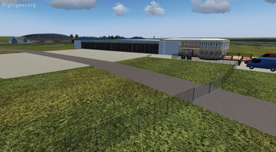
The main apron is located in front of the Flight Control along the taxiway E. In the northwest - also along the taxiway E - an additional parking surface is available.
- Parking Positions: Apron1SW, Apron2SW, Apron3NW
Aviation club
At the east of the Flight Control Building – near the THR30 - there is the area of the Fliegerclub Grossenhain e.V. with parking place and a club house. It is connected by taxiways E and C. Here you can start your engine too.
- Parking Positions: Club1
Flying museum
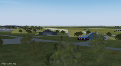
The hangar of the flying museum (German: Fliegendes Museum) is located to the southwest of the Runway. This hangar has a connection to the taxiway E via taxiway H.
- Parking Positions: Museum1
Scenery
The development of modeling the airport buildings started 2013 and are available via TerraSync.
- detailed, phototextured and handcolored 3D models of all buildings
- illuminated areas by night textures or rembrandt light
- fully Rembrandt compatible
- prepared for custom AI traffic
Scenery Add-on
A custom FGscenery_Saxony package is available for download. This Scenery add-on may contain traces of airport data, airport layouts, airport buildings and more which are not available via Terrasync and is steadily increasing with the development of selected airfields of Saxony. Have a look at the List of airports in Germany or on this map to gain an overview about the current custom scenery of saxony. For Grossenhain Airfield this package contains a custom airport layout (scenery tile), static buildings and airport data. To use the grass runway 12 and 30 choose the start-up positions 12R and 30L. Note: the start-up positions are not usable in-sim (no apt.dat update)
Always get the newest development version automatically: Download the FGscenery_Saxony.zip
Download via TerraSync
TerraSync has it all! You don't need to download a custom scenery. Terrasync makes it easy for every user always to have the latest scenery installed automatically.
- Last updates:
- 2015-05-11 update present models and add more
- 2013-04-08 buildings published
Related content
External links
- Airport Diagrams
- Grossenhain Airfield at Wikipedia (German)
- Fliegendes Museum (German)

