User:Wlbragg: Difference between revisions
No edit summary |
No edit summary |
||
| (One intermediate revision by the same user not shown) | |||
| Line 76: | Line 76: | ||
[[File:Iss4.jpg|512px|frame|International Space Station]] | [[File:Iss4.jpg|512px|frame|International Space Station]] | ||
[[File:AirCrane_over_Eldorado_Refinery.jpg|1024px|frame|AirCrane over the ElDorado Refinery]] | |||
[[File:Aircrane Over the Mojave.jpg|1024px|AirCrane over the Mojave Desert in the Palmdale/Landcaster area. Compositor shadows, OSM2CITY models, ALS lighting and Orthographics texture.]] | |||
[[File:Aircrane Over the Mojave 2.jpg|1024px|AirCrane over the Mojave Desert in the Palmdale/Landcaster area. Compositor shadows, OSM2CITY models, ALS lighting and Orthographics texture.]] | |||
{{-}} | {{-}} | ||
Watch this page for future releases of various project for [[FlightGear]]. I hope to have a couple of surprises just around the bend. | Watch this page for future releases of various project for [[FlightGear]]. I hope to have a couple of surprises just around the bend. | ||
Revision as of 17:30, 9 December 2020

Kansas/Midwest Scenery Development
Hello and welcome to my Kansas/Midwest scenery development page.
Hopefully in the weeks, months and years to come, I can contribute some useful Midwest Scenery and Airport Data.
Airport Layouts
So far, I have updated and submitted airport layouts to the FlightGear project for
- KEQA
- 3AU
- KRCP
I have a few more in the works and plan to eventually add terminals and structures to as many Kansas Airports as I have the motivation to finish.

Cargo Towing Project
I'm also currently working on a Cargo Towing project that give the ability to any helicopter to haul cargo from either a docked or slung position.
Version 1.2 - Hard Dock Milestone (early stable stage, no bells and whistles)
Version 1.3 - Tow Rope Milestone (very early stage)

Kansas Custom Scenery
I also have custom scenery generated from a combination of
- NLCD (land cover)
- OSM (roads, rivers and rail)
- SRTM (water data)
- New CS Data
- custom textures
for the entire state of Kansas
This is currently very heavy data but works surprisingly well on my mid level CPU and graphics card.
- Kansas Scenery
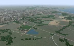
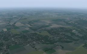
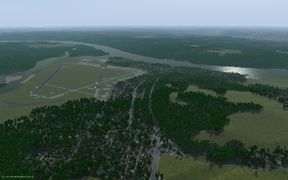
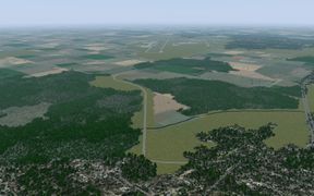
ElDorado, Kansas
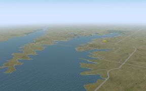
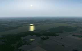
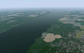
ElDorado Lake
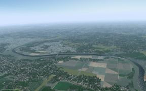
Kansas City
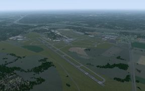
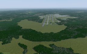
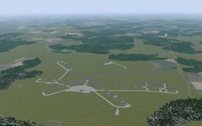
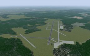
KICT - Wichita Dwight D. Eisenhower National Airport (Mid-Continent)
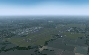
KIAB - McConnell AFB, Wichita
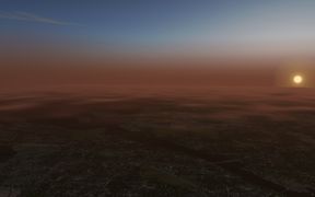
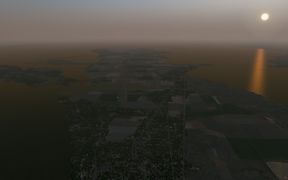
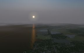
Kansas Sunset
KMCI - Kansas City International Airport
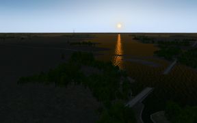
Sunset at ElDorado Lake
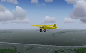
Cub at ElDorado Lake


Ohio Custom Scenery
Custom scenery generated from a combination of
- CS Data based on NLCD (land cover)
- OSM (roads, rivers and rail)
- SRTM (water data to come)
- custom textures
for the entire state of Ohio.
- Ohio Scenery
KLUK - Cincinnati Municipal Airport
Toledo - Harbor View
KCLE Cleveland-Hopkins International Airport
KPCW - Carl R Keller Field
KCAK Akron-Canton Regional Airport
KSKY - Griffing Sandusky Airport
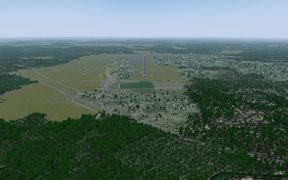
KCMH Port Columbus International Airport
KDAY James M. Cox Dayton International Airport
KYNG Youngstown - Warren Regional Airport
Near Youngstown


Surprise


Watch this page for future releases of various project for FlightGear. I hope to have a couple of surprises just around the bend.