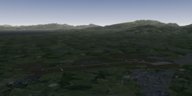
Verona Villafranca Airport
 | ||||||||||
| Type | Civil | |||||||||
|---|---|---|---|---|---|---|---|---|---|---|
| Owner | Aeroporto Valerio Catullo di Verona Villafranca S.p.A. | |||||||||
| City | Villafranca di Verona | |||||||||
| website | ||||||||||
| ||||||||||
| Scenery tile | e010n45 | |||||||||
| TerraSync | 2D layout submitted Mar 2015 | |||||||||
| Download | ||||||||||
Verona Villafranca Airport is an international airport located 2.7 NM southwest of Verona (northern Italy). It serves a population of about four million people from eastern Lombardy, Trentino Alto Adige and western Veneto.
Up to 2008 it was classified as a military airport open to civil traffic.
Technical characteristics
The airport has only one runway (044°/224°), 3068 m long and 45 m wide.
- General aviation and light planes can use both directions for departure (though runway 04 is preferred); heavy aircraft always depart from runway 22.
- Runway 22 is suitable only for visual approaches by light aircraft (for terrain clearance reasons).
- Runway 04 is suitable for all landings and is served by a CAT IIIb ILS system (frequency: 110.10 MHz).
The apron is located on the north-east side; three taxiways (W, Y and K) lead directly to the runway. Another taxiway (T) runs parallel to it. The west side features three "rings" used by military aircraft.
Operational considerations
High mountainous terrain north of the airport requires pilots to perform steep maneuvers. It is advisable to study available charts carefully.
- When departing from runway 04 the plane must perform a right turn (not a left one, that's a common error, especially when using the autopilot; the heading is 154 or 245, depending on the SID in use) after passing 750 ft. North- and eastbound SIDs require multiple turns to gain altitude; missed approach procedures are similar.
- When landing from the North, the STARs have a steep descent profile. It is suggested to:
- cross the Alps at or above FL150;
- descend to FL120 over Lake Garda, reducing airspeed to 230 kts or less;
- follow the STAR and fly at the minimum safe altitudes/flight levels (marked "MEA" or "MEL" on the charts). False glideslope captures may occur during the descent, they are to be ignored;
- reduce airspeed to 180 kts before turning final;
- make the final left backdrop turn over GAZ when the plane is at most one or two NM away from the VOR.
The area is subject to heavy fog in autumn and winter (visibility often decreases to just a few hundreds of meters); use of a CAT III ILS equipped plane is strongly recommended.
Custom scenery
elgaton is currently redesigning the airport from scratch so that the scenery is as faithful as possible to the real aerodrome. The dedicated forum thread hosts the most recent download, as well as a detailed changelog, and is the preferred way to report bugs.
The 2D layout was submitted for inclusion in March 2015; 3D objects will be published via TerraSync.
Progress
The following table might take into account improvements available only in the current development version and not in the latest publicly available beta.
| Task | Progress | Remarks |
|---|---|---|
| Runway, beacon, PAPI | ||
| Taxiway layouts | ||
| Taxiway markings | ||
| Taxi signs | ||
| Apron | ||
| Buildings | ||
| Parking positions and ground net |
ATC service
ATC service is provided regularly on weekends - check Lenny's website for the exact times and dates.