File:Fgfs-20220208201349.jpg
Jump to navigation
Jump to search
Size of this preview: 800 × 450 pixels. Other resolution: 2,560 × 1,440 pixels.
Original file (2,560 × 1,440 pixels, file size: 301 KB, MIME type: image/jpeg)
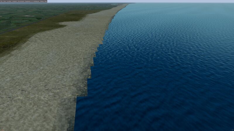
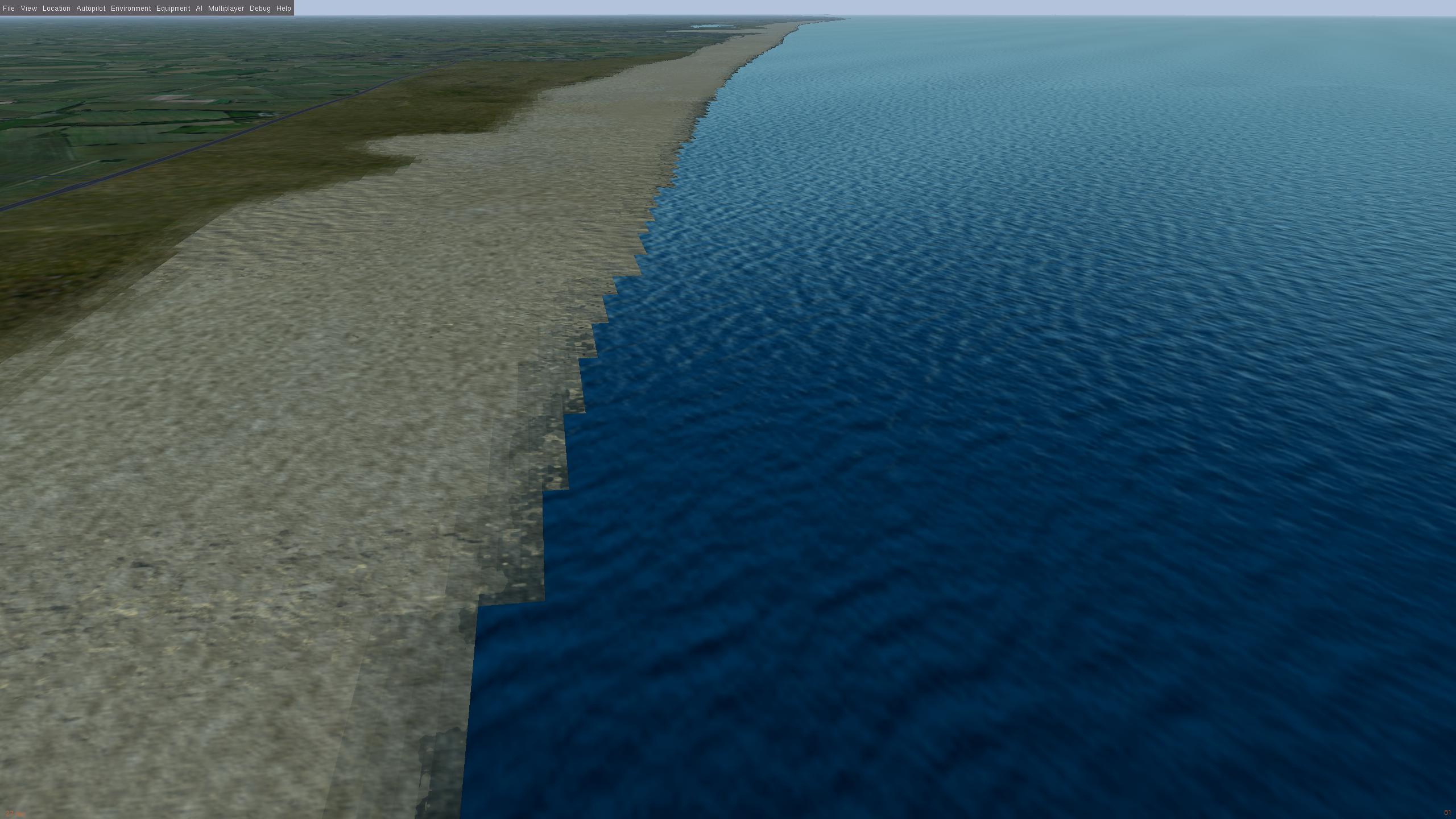
WS3.0 with 10m resolution raster at 500ft altitude, clearly showing the problem with coastline edges
File history
Click on a date/time to view the file as it appeared at that time.
| Date/Time | Thumbnail | Dimensions | User | Comment | |
|---|---|---|---|---|---|
| current | 18:12, 19 February 2023 | | 2,560 × 1,440 (301 KB) | Stuart (talk | contribs) |
You cannot overwrite this file.
File usage
The following page uses this file: