Category:Maps
Jump to navigation
Jump to search
(en) Category with various maps and charts.
Subcategories
This category has the following 6 subcategories, out of 6 total.
C
L
- Location maps (24 F)
M
- MPMap screenshots (24 F)
P
- Procedure charts (7 F)
S
V
- Virtual airline route maps (4 F)
Media in category "Maps"
The following 36 files are in this category, out of 36 total.
- 1c9334d970963364b5ce1bc3a166a4fa.media.426x192.png 426 × 192; 44 KB
- 2011-11-20 - scenery buckets.png 1,024 × 595; 1.04 MB
- Ac001 egll runway icao.jpeg 1,174 × 305; 404 KB
- Adg-KSFO-0.png 1,240 × 1,755; 252 KB
- Adg-KSFO-1.png 1,240 × 1,755; 722 KB
- AVB Area-F.jpg 1,827 × 956; 536 KB
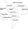
- AW Weather patterns.jpg 496 × 500; 33 KB
- Browsermap-2.jpg 1,394 × 861; 387 KB
- Browsermap-3.jpg 1,394 × 861; 536 KB
- Browsermap-4.jpg 1,394 × 861; 521 KB
- C172-VFR-Approach-KLVK.png 300 × 422; 324 KB
- C31e36f2a2cbb278a1603dfe2ba91193.media.395x288.png 395 × 288; 73 KB
- Choose your desired area.JPG 1,024 × 768; 192 KB
- Climatic snow line.png 689 × 480; 16 KB
- Clip0437 0002.jpg 434 × 326; 76 KB
- Combat Mission Plotter PLU-6C.png 1,702 × 1,114; 255 KB
- Dubai v0 vs cs-osm.png 1,852 × 698; 84 KB
- ED02-LIPB.jpg 2,234 × 4,113; 2.62 MB
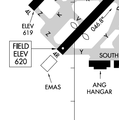
- Emas marked on chart.png 359 × 361; 26 KB
- Emas.png 725 × 302; 83 KB
- JFlightWizard.jpg 640 × 426; 44 KB
- JMapView EHAM.jpg 916 × 742; 146 KB
- Lax.jpg 810 × 622; 108 KB
- Manhattan v0 vs cs-osm.png 1,246 × 866; 88 KB
- NTTR.jpg 1,716 × 971; 538 KB
- Ox.jpg 815 × 621; 126 KB
- Photoscenery-GUI-Beta-20250810.png 1,280 × 709; 1.72 MB
- Qatar v0 vs cs-osm.png 1,090 × 692; 61 KB
- RGATC-Approach-Pattern.jpg 1,280 × 720; 435 KB
- RGATC-Approach.jpg 1,280 × 720; 457 KB
- Routedom.png 740 × 428; 49 KB
- Texel v0 vs cs.png 769 × 598; 22 KB
- The Paro Challenge route.png 1,287 × 2,567; 6.91 MB
- Westfrisian Islands.png 1,067 × 884; 23 KB
- Worldscenery-text.jpg 846 × 588; 410 KB
- WorldTour.gif 720 × 360; 51 KB


