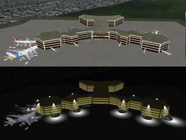
Ninoy Aquino International Airport
 RPLL Terminal 1 | |||||||||||||
| |||||||||||||
| Type | public | ||||||||||||
|---|---|---|---|---|---|---|---|---|---|---|---|---|---|
| Owner | tbn | ||||||||||||
| City | Manila, Philippines | ||||||||||||
| website | |||||||||||||
| |||||||||||||
Ninoy Aquino International Airport, (Filipino: Paliparang Pandaigdig ng Ninoy Aquino) or NAIA (pronounced /ˈnaɪ.ə/), (IATA: MNL, ICAO: RPLL) is a public airport located in Philippine's capitol city of Manila between the districts of Pasay and Paranaque, Philippines. NAIA serves the international and national air traffic for the country on the island of Luzon.
The airport was initially named as "Manila International Airport." before being renamed in 1987 after Benigno "Ninoy" Aquino, Jr., who was assassinated at the airport four years earlier in 1983.
Following the Philippine's Independency in 1948, NAIA moved to it's actual location. Because a fire damaged Terminal 1 in 1972, it was rebuild completely, with a capacity of 4.5 million passengers per year. NAIA-1 has 18air bridges and serves 27 airlines. Terminal 2 (nicknamed "Centennial Terminal") completed in 1998 adding the capacity of another 2.5 million passengers for international flights plus 5 million passengers for domestic arrivals and departures. NAIA-2 is exclusively used by Philippines Airlines (PAL) with it's 12 air bridges distributed over the north- and south wing to separate domestic from international arrivals and departures. Terminal 3 followed in 2008 adding the capacity of approximately 13 million passengers per year. NAIA-3 has 16 air bridges and serves Cebu Pacific Airlines (CEB), "Air Philippines" and PAL's budget brand "PAL Express" for domestic and international flights.
Runway Information
| Runway 06/24 | ||
|---|---|---|
| Dimensions: | 12261 x 197 ft / 3737.2 x 60.0 m | |
| Runway 06 | Runway 24 | |
| Longitude: | 120.999997 / E 120° 59' 59.99" | 121.030114 / E 121° 01' 48.41" |
| Latitude: | 14.497767 / N 14° 29' 51.96" | 14.514503 / N 14° 30' 52.21" |
| End Elevation: | 16.0 ft | 75.0 ft |
| Alignment: | 062.0 | 242.0 |
| Slope: | 0.5 | -0.5 |
| Touchdown Zone Elev.: | 24.0 | 75.0 |
| Displaced Threshold: | 580 ft | 490 ft |
| Lighting System 1: | Sequenced Flashing Lights | Sequenced Flashing Lights |
| Lighting System 2: | Centerline Lighting System | Centerline Lighting System |
| Lighting System 3: | High Intensity Runway Lights | High Intensity Runway Lights |
| Lighting System 4: | SALS or SALSF | SALS or SALSF |
| Lighting System 5: | PAPI - Precision Approach Path Indicator | PAPI - Precision Approach Path Indicator |
| Runway 13/31 | ||
|---|---|---|
| Dimensions: | 7408 x 148 ft / 2258.0 x 45.1 m | |
| Runway 13 | Runway 31 | |
| Longitude: | 121.003464 / E 121° 00' 12.47" | 121.018331 / E 121° 01' 05.99" |
| Latitude: | 14.524214 / N 14° 31' 27.17" | 14.509836 / N 14° 30' 35.41" |
| End Elevation: | 16.0 ft | 42.0 ft |
| Alignment: | 136.0 | 316.0 |
| Slope: | 0.4 | -0.4 |
| Touchdown Zone Elev.: | 25.0 | 42.0 |
| Displaced Threshold: | 665 ft | 760 ft |
| Lighting System 1: | PAPI - Precision Approach Path Indicator | PAPI - Precision Approach Path Indicator |
Remarks
- Caution - WIP. Bird haz - act hvy fr Feb thru Apr and Aug thru Oct.
- Fuel - A1 (Safeair Corp), (NC-80, 100, 115, B) PPR.
- Miscellanouis - Rwy 13 displ thld mrk extn thru NW apn. Displ thld Rwy 31 unmarked.
- Noise Abadment - See FLIP PLANNING AP/3.
- Restricted - Two-way rdo rqr. TD with Mode C rqr wi Manila TMA exc helicopters blw 1000' MSL. Trng flt proh wi arpt. Speed rstd for arr acft not to exceed 250 K IAS unless auth by ATC. Rwy 06-24 clsd to acft opr btn 1730-1930 dly for rwy maint. SVFR sus
- Restricted - pd due to tfc congestion Rwy 06/24. Btn 0300-0800Z IMC non-sked acft with cruise speed 180 Kt or blw proh ldg Rwy 06-24. Rwy 13/31 for day VFR OPS only.
- Traffic Pattern - See Section E.
Airport Communications
| Type | Name | Freq 1 | Freq 2 | Freq 3 | Freq 4 | Freq 5 |
|---|---|---|---|---|---|---|
| Approach/Departure Control | MANILA APP | 119.7 M | 121.1 M | |||
| Area Control Center | MANILA CON | 128.3 M | ||||
| Automatic Terminal Information Service | MANILA ATIS | 126.4 M | ||||
| Clearance Delivery 1 | CLNC DEL | 125.1 M | ||||
| Flight Service Station | MANILA RDO | 5447.5 K | 3834 K | |||
| Ground Control | GND | 121.8 M | ||||
| Ramp Control 1 | RAMP 1 | 121.7 M | 121.6 M | |||
| Tower | MANILA TWR | 118.1 M |
Communication Remarks
- Clearance Delivery - DEP DOMESTIC IFR FLT - call 5 min prior to eng start specifying preferred rwy and required ATC clearance. DEP INTL IFR FLT - call 5 min prior to eng start. Failure to start engine within start-up time renders ATC clearance void necessitatin
- Clearance Delivery - g an addn 25 min prior call-up. Anticipated start-up delay should be relayed to CLNC DEL
- Ramp Control - Call 5 min before eng start to receive start-up, push-back clnc. INTL RAMP 121.7, Acft in NAIA General Aviation areas contact DOMESTIC RAMP 123.25 prior to start and taxi for traffic advisories, CENTENNIAL II RAMP 128.8. Acft at trml III, T
- Ramp Control - wy N ctc GND CON on 121.9. Start-up, push-back only aft receipt of clnc from RAMP CON. Entry to main twy or rwy only aft clearance fr GND CON on 121.9. If ctc not estab with RAMP CON, flw-me veh is mandatory