London Gatwick Airport
 | |||||||||||||
| Type | Public | ||||||||||||
|---|---|---|---|---|---|---|---|---|---|---|---|---|---|
| Owner | Global Infrastructure Partners | ||||||||||||
| City | London, United Kingdom | ||||||||||||
| website | |||||||||||||
| |||||||||||||
| Scenery tile | w010n50 | ||||||||||||
| TerraSync | Published | ||||||||||||
| Download | |||||||||||||

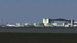
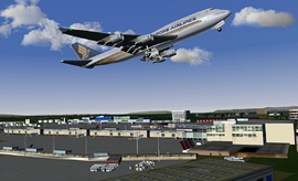
London Gatwick Airport (IATA: LGW, ICAO: EGKK), located 28 miles south of London, is the world's busiest single-use runway airport - actually 9th busiest in terms of international passengers. About 30 million passengers and 75,00 metric tons of cargo are handled annually.
Regular users of the airport are - Aer Lingus, Air Malta, British Airways, Croatia Airlines, Cyprus Tukey Airlines, Delta, Easy Jet, Emirates, FlyBe, Iraqui Airways, Malev, Mexicana, Monarch, Qatar, Royal Air Maroc, Scandanavian, TAP, Thomas Cook, TUI Airways, United Airways, US Airways, Virgin Atlantic and your-own-airline-here.
London Gatwick is one of the most detailed airports in FlightGear with full day and night textures for all buildings.
Runway operations
Runway 08L/26R is mainly used as a taxiway but sometimes used as a runway if an accident or maintenance closes down the main runway.
- apron concrete
- taxiways concrete/asphalt
The airport is operating 24 hr with some restrictions in night flying.
Facilities
South terminal
- pier 1 small aircraft; gates 1-10
- pier 2 medium/heavy aircraft; gates 11-28
- pier 3 heavy aircraft; gates 31-38
North terminal
- pier 4 heavy aircraft; gates 46-54
- pier 5 heavy aircraft; gates 54-63
- pier 6 heavy aircraft; gates 102-111
Cargo
- apron cargo aircraft; gates 150-159
West Park
- apron medium/heavy aircraft; gates 130-140; 160-180
FlightGear scenery
FlightGear model download available per seperate download or TerraSync. The related FlightGear scenery tile is w010n50.
<?xml version="1.0"?>
<PropertyList>
 <jetway>
   <model type="string">generic</model>
   <gate type="string">53</gate>
   <door type="int">1</door>
   <airline type="string">None</airline>
   <latitude-deg type="double">51.15856109</latitude-deg>
   <longitude-deg type="double">-0.1760064073</longitude-deg>
   <elevation-m type="double">-6.33300781</elevation-m>
   <heading-deg type="double">13.619836</heading-deg>
   <initial-position>
     <jetway-extension-m type="double">0</jetway-extension-m>
     <jetway-heading-deg type="double">0</jetway-heading-deg>
     <jetway-pitch-deg type="double">0</jetway-pitch-deg>
     <entrance-heading-deg type="double">0</entrance-heading-deg>
   </initial-position>
 </jetway>
</PropertyList>
will add an animated jetway at parking 54, which will connect to the 2L door of a 777. (needs to be added to Airports/EGKK.jetways.xml
Communications
| ATIS | 136.525 |
|---|---|
| TWR | 124.225 |
| TWR | 134.225 |
| GND | 121.800 |
| OCK | 115.3 | 139 deg | 13 nm |
|---|---|---|---|
| BIG | 115.1 | 225 deg | 13.5 nm |
Pilot notes
Normal landing and takeoff is on runway 26L, with a heading of 260 deg and an elevation of 196ft AMSL.
| ILS | I-WW | 110.9 | Cat III |
|---|
Taxiways and parking is rather complex and a chart is recommended. You may download and use the official and up-to-date UK CAA charts of Gatwick from this link. The official charts cover taxiways, SIDs, STARs - and much more detail than you can use.
A simplified approach procedure via MAY
| MAY | 220kts | 4000ft | 005deg | 117.9MHz |
|---|---|---|---|---|
| MAY D3 | 200kts | 3000ft | 005deg | 117.9MHz |
| MAY D8.5 | 200kts | 2000ft | 262deg | 117.9MHz |
| D004 | 200kts | 2000ft | 262deg | 110.9MHz |
| C126L | 200kts | 2000ft | 262deg | 110.9MHz |
| GE | 180kts | 2000ft | 262deg | 110.9MHz |
| FAP5.5 | 160kts | 2000ft | 262deg | 110.9MHz |
| D4 | 150kts | 1525ft | 262deg | 110.9MHz |
| D1 | 135kts | 565ft | 262deg | 110.9MHz |
A simplified departure procedure via SFD
| EGKK | 150kts | 1000ft | 262deg | 124.22MHz |
|---|---|---|---|---|
| SFD R320 | 200kts | 2500ft | 262deg | 117.00MHz |
| SFD R313 | 220kts | 4000ft | 133deg | 117.00MHz |
| SFD | 250kts | 8000ft | 133deg | 117.00MHz |