File:Germany extents coordinates.png
Jump to navigation
Jump to search

Size of this preview: 473 × 599 pixels. Other resolution: 989 × 1,252 pixels.
Original file (989 × 1,252 pixels, file size: 353 KB, MIME type: image/png)
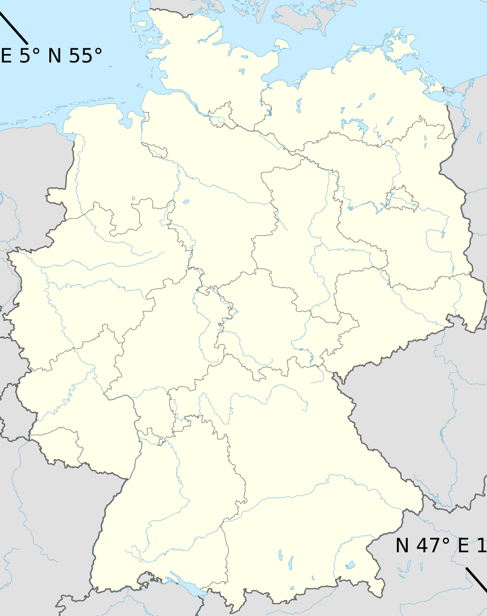
Map of Germany showing the coordinates of it's bounding box. This image was derived from https://en.wikipedia.org/wiki/File:Germany_adm_location_map.svg by converting it to a PNG file and drawing two lines an adding the coordinates text.
File history
Click on a date/time to view the file as it appeared at that time.
| Date/Time | Thumbnail | Dimensions | User | Comment | |
|---|---|---|---|---|---|
| current | 22:17, 29 July 2021 | | 989 × 1,252 (353 KB) | TheEagle (talk | contribs) |
You cannot overwrite this file.
File usage
The following page uses this file: