File:Windboundaries.png
Jump to navigation
Jump to search
No higher resolution available.
Windboundaries.png (660 × 231 pixels, file size: 35 KB, MIME type: image/png)
Summary
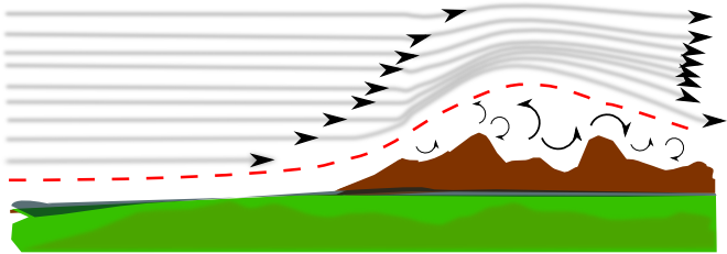
| Description | (en) Another Horrible drawing based on A horrible (I like) drawing giving an idea of what's the boundary layer by Bigstones (I-NOOB) revisited By Michat |
| Date | 5 June 2014 , 01:22:52 |
| Source | Own work |
| Author | Aepcam |
|
Location on Earth |
|
View this and other nearby images on: Google Maps - Google Earth OpenStreetMap | (Info) |
|---|
Licensing
|
File history
Click on a date/time to view the file as it appeared at that time.
| Date/Time | Thumbnail | Dimensions | User | Comment | |
|---|---|---|---|---|---|
| current | 23:26, 4 June 2014 | 660 × 231 (35 KB) | Aepcam (talk | contribs) | User created page with UploadWizard |
You cannot overwrite this file.