Aviano Air Base
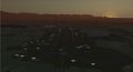
 Overview of the base in TerraSync. | ||||||||||
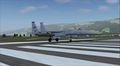
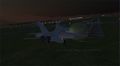
 Tower view. | ||||||||||
| ||||||||||
| Type | Military | |||||||||
|---|---|---|---|---|---|---|---|---|---|---|
| Owner | Aeronautica Militare Italiana; US Air Force (user) | |||||||||
| City | Aviano, Pordenone, Italy | |||||||||
| website | ||||||||||
| ||||||||||
| Scenery tile | e012n46 | |||||||||
| TerraSync | Yes | |||||||||
Aviano Air Base (commonly wrote Aviano AB or improperly Aviano AFB) is a NATO base built in 1911 in the Italian region of Friuli-Venezia_Giulia ![]() . It is located in the Aviano
. It is located in the Aviano ![]() municipality, at the foot of the Carnic Pre-Alps, (reason why local people call it "Pedemontana"), at about 8 NM from Pordenone.
The Italian Air Force
municipality, at the foot of the Carnic Pre-Alps, (reason why local people call it "Pedemontana"), at about 8 NM from Pordenone.
The Italian Air Force ![]() has administrative control of the base which hosts the U.S. Air Force
has administrative control of the base which hosts the U.S. Air Force ![]() 's 31st Fighter Wing
's 31st Fighter Wing ![]() .
The 31st FW (which commander is Brig. Gen. Barre Seguin) is assigned to the United States Air Forces in Europe
.
The 31st FW (which commander is Brig. Gen. Barre Seguin) is assigned to the United States Air Forces in Europe ![]() major command and the Third Air Force
major command and the Third Air Force ![]() . It's the only U.S. fighter wing south of the Italian Alps. This strategic location makes the wing critical to operations in NATO's southern region. The 31st FW maintains two F-16 fighter squadrons, 555th Fighter Squadron "Triple Nickel"
. It's the only U.S. fighter wing south of the Italian Alps. This strategic location makes the wing critical to operations in NATO's southern region. The 31st FW maintains two F-16 fighter squadrons, 555th Fighter Squadron "Triple Nickel" ![]() and the 510th Fighter Squadron "Buzzards"
and the 510th Fighter Squadron "Buzzards" ![]() , allowing the wing to conduct offensive and defensive combat air operations.
In peacetime, the 31st FW prepares for its combat role by maintaining aircraft and personnel in a high state of readiness, with a nearly every-day air training sessions, combat simulations and practice operations.
In FlightGear the base is used on a daily basis by the OPRF military group which conducts various exercises and combat sorties with a wide variety of aircrafts.
, allowing the wing to conduct offensive and defensive combat air operations.
In peacetime, the 31st FW prepares for its combat role by maintaining aircraft and personnel in a high state of readiness, with a nearly every-day air training sessions, combat simulations and practice operations.
In FlightGear the base is used on a daily basis by the OPRF military group which conducts various exercises and combat sorties with a wide variety of aircrafts.
History
Aviano Air Base (in Italian: Base aerea di Aviano) is one of the oldest military airports in Italy, established by the Italian government in 1911, it was used as training base for Italian pilots and construction facility for aircraft parts. During WWI, Italy used the airfield in missions against the Austro-Hungarian and German armies. At that time, two Italian aviators, Captain Maurizio Pagliano and Lieutenant Luigi Gori, conducted an unauthorized, but heroic and successful, air raid on the Austrian naval yards in Pula, in what is now Croatia. In their honor, the base's name was officially changed to "Aeroporto Pagliano e Gori", in 1919. During the war the airfield was also overrun by the Austro-German army in the months between November 1917 to November 1918. Between the two wars the airfield was again used as a training base. In the WWII, both the Italian Air Force and the German Luftwaffe flew missions from it. British forces captured the base in 1945; they conducted air operations there up to 1947, when the Italian Air Force resumed operational use of the airport and resized it in the early 50s until the arrival of the US Air Force. In 1954, the US Government signed with the Italian Government an agreement for the joint use of the base which became NATO. In the years 1950-1990, Aviano housed in turns fighter squadrons, in support of the tasks assigned to NATO and deployments of the Air Force tasked with training in the use of weapons.
About the 31st Fighter Wing at Aviano
Before being deployed in Italy, the 31 FW had its home at Homestead Air Force Base, Florida. In the end of August 1992, Hurricane Andrew swept across southern Florida, leaving extensive damage in its wake. Every building of Homestead AFB received some damage and many buildings were destroyed. The fighter squadrons evacuated most of the planes before the storm but were unable to return. In the aftermath, the secretary of defense recommended closure of the base (then used by the Air Force Reserve) and inactivating the 31st FW. To avoid losing the wing’s heritage and history as the highest scoring Army Air Force unit in the Mediterranean Theater in WWII, the impressive combat record in Vietnam and number of significant firsts they produced in the early years of the Air Force, the 31 FW was chosen to move rather than fade into obscurity. On April 1, 1994, the 31st Fighter Wing inactivated at Homestead AFB and subsequently activated at Aviano Air Base, Italy in place of the 401st Fighter Wing.
Between the 1990s and 2005 and then in 2011, Aviano hosted various aircrafts for multiple operations in ex-Jugoslavia, Iraq and Lybia and deployed aircrafts to Iraq, Lybia, Afghanistan and (presently) in Turkey in support of Operation Inherent Resolve.
Apart from the local F-16s, many U.S. planes arrive/set off to/from Aviano AB, like C-130/J, C-17 and weekly Space-A charter flights from/to Ramstein Air Base and Baltimore (usually on Wednesday).
Technical characteristics
Aviano AB's elevetion is 410 ft (125 m).
Runway
The airport has only one runway (045°/225°), 2987 m long and 55 m wide. (Both runways 05 and 23 will have got two BAK-12 aircraft arresting systems for emergency landings and training in the beta version).
- Both directions are used for takeoffs (though runway 05 is much preferred).
- Runway 23 is not used a lot for landings (except when there is strong down wind), for visual approaches only.
- Runway 05 is suitable for all landings and is served by an ILS system (frequency: 390.00 MHz).
Layout
- Area A1 contains a few of Aviano's support functions (such as the library and chapel) and the Department of Defense Dependents School for the base population's children.
- Area A2 contains a fitness centers, dining facility, dormitories, thrift shop and a fire department.
- Area C contains most of the 31st Civil Engineer Squadron's facilities.
- Area D contains a soccer field and picnic area.
- Area E contains AFN, military working dog kennels and Air Force Office of Special Investigations detachment. The Italian Carabinieri (military police) also have their base headquarters in this area.
- Area F is the flightline area and is the largest area in Aviano. The complex contains the active runway and taxiways and most of the base's facilities like the AMC passenger terminal, the legal office and the Commissary.
Aprons for transport aircrafts, tankers, etc. are located on the north/north-east sides, east side, south-west side; Four taxiways lead directly to the runway. Two taxiways run parallel to it. The north-west side, the south-west side and the south side feature "rings" used by fighter aircrafts. The north-east side feature an area/ring for helicopters.
Operational considerations
| Note Some charts will be provided shortly about take-off/land procedures. |
High mountainous terrain north of the airport requires pilots to perform steep maneuvers if arriving from north or going north. It is advisable to study available charts carefully.
When departing from runway 05 the plane must (unless stated by ATC) perform a right turn just a bit after take-off to heading 110-120. If going north (e.g. charter flight to ETAR) the aircraft needs to gain altitude quickly during a large circle around the air base before turning right again to 340-350 and going north.
Missed approach procedures are not similar: depending on wind, weather conditions and aircraft size, the aircraft has to:
- turn left to 230, climb to 1,400 ft and mantain a speed of 280-220 (depending on the aircraft) then wait till reaching the NDB and turn to 160 starting to descend and then final to 050 at the NDB;
- turn right to 230, climb to 2,400 ft and mantain a speed of 300-240 (yet depending on the aircraft) the wait till the aircraft passes the NDB of about 4-5 NM and turn to 020 starting to descend and then final to 050. In this type of approach the NDB should be in front of you when turning final.
Touch n go approach (often used by fighters) are very similar to the first missed approach procedure:
- turn left to 225, climb to 1,000 ft and mantain a speed of 280-260 (depending on the fighter) then wait till reaching the NDB and turn to 150 starting to descend and then final to 050 at the NDB.
When landing from the North, it is suggested to:
- cross the Alps at or above FL140;
- turn right to 220 and descend to FL120 before reaching the end of the Alps, reducing airspeed to 270 kts or less;
- continue like this until arriving to the beginning of the glideslope in the FGMap and then turn to 150, descending to FL090.
- reduce airspeed before turning final and land on runway 05.
The area (likely to LIPX) is often subject to fogs in autumn and especially winter seasons (sometimes also during spring and summer during bad weather conditions due to its proximity to the Carnic Pre-Alps just a few miles away) so visibility often decreases to just a few hundreds of meters. It is recommended to follow ATC guidance if present or use ILS.
Communications
FGCom frequencies
(The following table takes into account some frequencies available only in the current development version.)
| ATIS | 129.300 |
|---|---|
| TWR | 142.050 |
| GND | 122.100 |
| CLNC DEL | 122.100 |
| APP | 120.120 |
| APP 2 | 120.125 |
| APP (ItAF-USAF) | 134.100 |
| DEP | 142.350 |
| AVI | 111X, | 00 NM |
|---|
| AVI | 390, | 046.0 deg, | 9.5 NM |
|---|
Custom scenery
J Maverick 16 is currently redesigning the airport so that the scenery is as faithful as possible to the real air base. The airport will be submitted for inclusion in the international scenery as soon as the ground layout and the buildings are done; further updates (more buildings, boundaries, decorations...) will be released via TerraSync. A first preview of the beta can be found on GitHub (unused). As of 2019/05, the development version layout requires an overall review and update, release timing remains unknown. Presently, several shared objects (tower, radar, shelters, aircrafts, etc.) have been submitted and included in TerraSync but will be replaced once the final version becomes available.
Progress
The following table takes into account improvements available only in the current development version.
| Task | Progress | Remarks |
|---|---|---|
| Runway, beacon, PAPI, ILS, Tower | Shoulders have been added and the runway prolonged and adapted as the real one; beacon has been moved out of a taxiway, PAPI have been moved to the real position and the ILS system on rwy 05 moved away from the edge; the tower position has been moved to the current position. | |
| Taxiway layouts | Re-designed all of them with a lot of accuracies. | |
| Taxi signs | All signs are placed correctly. | |
| Aprons | A lot of small parkings have been added/edited in Area F, especially the great one on the left side of rwy 23, need only a few fine tunings. Edited the northeast zone of parkings and the southwest. Also some parts of the internal area of the base are ready. | |
| Buildings | Some of them have been added with the current layout version (as seen in the img above), but need to be completely replaced with the new one. Some buildings have to be created from scratch. A custom tower with the 31st FW emblem has been added. | |
| Parking positions and ground net | Most of the parking positions have been added, net is almost ready. | |
| Exclusion zones | They include also the internal part of the base. | |
| Roads | The base has lots of roads, most of them are created, need to fix some curves. | |
| Comprehensive air base scenery | The ground layout is nearly ok, taxi signs are placed, the aprons need only some fine edits, buildings have to be repositioned and some must be created, most the ground net and taxi lights are added and most of the parking positions have been set. |
ATC services (USAF_AV)
| Note IMPORTANT: When under ATC guidance, please start your MP session on any suitable apron OR at least on rwy 05 |

ATC service is provided with OpenRadar regularly on weekends and weekdays, using also Mumble and the Discord server (sometimes also FGUK's Teamspeak channel too) - check Lenny's website for the exact times and dates, but usually on Sunday evenings and Tuesdays evenings. For further information about LIPA, you can download the chart on the right, use SkyVector and GCMAP. The air base is also included in the NIATCA project. To avoid pilot/ATC misunderstandings see the minimum list of best practices. Remember that this is a military American air base and not a civilian airport, with different rules and procedures so don't simulate an emergency or found an excuse to land/take-off from Aviano only because it is the only one controlled in that moment, especially for airliners (e.g. (and these ones all happened to me) terrorists on board, engine failure, passenger with cardiac arrest, President on board, very top secret mission, ...).
Aviano Open Days Week-end
Aviano Open Days Week-end will be a mega-event where every airman will be able to perform flights with any type of aircraft (from non-U.S. fighters to big airliners) during a whole week-end. ATC will be provided every day in 3-hour intervals (followed by 1 or 2 hours of free flying) from approximately 07:00 to 20:00 UTC time, with the possibility of having two towers controlling in the same time or replacing USAF_AV. Also airshows (one will be planned by FGUK) will be expected. Communications will happen on the MPChat, Mumble, Teamspeak and FGCom.
Screenshot gallery of LIPA
WED development
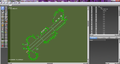
WED screenshot of Aviano before the developement
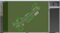
Screenshot of WED after the developing
WED screenshot after development
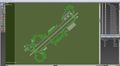
After nearly 2 years, this is the current LIPA layout (yet to be finished)


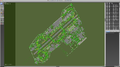
Old (current) layout version
Overview of the airfield with initial draft version of the custom scenery
F-15 ready for take-off from rwy 05
A Boeing 747-8i parked in the AMC apron by evening with custom buildings
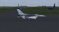
F-16 taxiing to parking after landing on rwy 05 with home livery
An F/A-18D Hornet landing on rwy 05
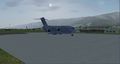
View of the Aviano Passenger Terminal with a C-17


New layout version
...
The Aviano AB Livery Pack for F-16CJ

The Aviano Air Base Livery Pack is a set of 10 USAF liveries used by squadrons and units in the base for the General Dynamics F-16CJ Fighting Falcon of FGUK created by Gary Brown and requested by J Maverick 16. List of liveries, development and preview from FGUK available here; from the FGForum here. All the said liveries plus 10 others can be currently found in the FGAddon F-16, or the constantly updated version on GitHub.