QRadioPredict
| Work in progress This article or section will be worked on in the upcoming hours or days. See history for the latest developments. |
| This article is a stub. You can help the wiki by expanding it. |
This GUI tool exploits the tremendous connectivity and capabilities of Flightgear. By running the telnet server of Flightgear at 100 Hz, we are pushing the limits of the props server, with great results. Analysis of radio path for site planning and simulation purposes is thus possible by using one mobile station, positioned anywhere in the Flightgear world, and up to three fixed stations, each of them having the principal characteristics like transmit power, antenna gain, antenna height etc. configurable via the interface.
Features
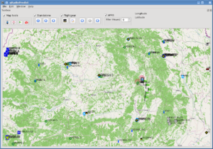
- Placing the mobile station on a 2D map provided by OpenStreetMap, or by open sattelite imagery.
- There is some support for proprietary data, such as Google Maps or sattelite images
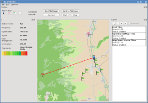
- Placing and configuring up to three fixed stations, which will transmit a signal to the mobile station.
- Setting the path that the mobile station will follow, via waypoints placed on the map.
- Signal and transmission analysis for the radio links, running at the rate at which the simulator itself is running.
- The mobile station will always follow the terrain, if the waypoints have no altitude specified.
- Radio parameters are: transmit power, receiver sensitivity, antenna gain on both parts, cable losses, antenna heights above surrounding terrain, polarization, antenna type (provides radiation patterns, see the main FGRadio article).
- The results are displayed both graphically and as real numbers, on a different tab for each station.
- The Irregular Terrain Model is used with some modifications, as well as the new algorithm designed to calculate losses caused by terrain type (wooded area, city, town, coniferous, mixed forests etc.)
- The newest ITWOM v3.0 model has been GPL'ed by John A. Magliacane, and is used inside the application
- QRadioPredict is capable of running standalone, without a Flightgear connection, using the same data which is used to generate Flightgear terrain. Interfacing with Flightgear still remains the preferred mode of operation, but this change implies that terrain loading limits which have placed limitations on maximum reliable prediction range will be gone.
- QRadioPredict is also capable of using more than three fixed radio stations.
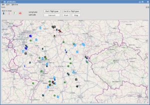
- APRS stations are displayed on map in real time, and also saved in history, with a configurable view time filter. This should allow practical tests of the algorithm for clutter loss.
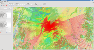
- A 2D plot model showing signal quality in colours. This works in a similar way to the Splat! and Radiomobile 2D plot generation. The plot and map can be zoomed in or out, and the plotting distance is easily configurable via the interface
Planned features
- APRS stations displayed on map will perhaps be sent to Flightgear for signal analysis in real time.
- More than one mobile station, as well as messaging between fixed-mobile, fixed-fixed, mobile-mobile.
- Improving performance of clutter calculations in standalone mode.
- Part of this code will be used to contribute to integrated FGCom realistic radios
Availability
QRadioPredict has standalone operation capabilities. Most of its issues are being ironed out. It is intended to be portable across different operating systems, with dependencies kept to a reasonable minimum. qRadioPredict requires GDAL in order to work with terrain shapefiles. More information can be found on the project page at QRadioPredict


