FlightGear WorldTerrain SkyBox Server
| This article describes content/features that may not yet be available in the latest stable version of FlightGear (2024.1). You may need to install some extra components, use the latest development (Git) version or even rebuild FlightGear from source, possibly from a custom topic branch using special build settings: This feature is scheduled for FlightGear (unknown). If you'd like to learn more about getting your own ideas into FlightGear, check out Implementing new features for FlightGear. |
| This article is a stub. You can help the wiki by expanding it. |
 | |
| Started in | 03/2013 |
|---|---|
| Description | FlightGear-based SkyBox server |
| Contributor(s) |
|
| Status | Under active development as of 03/2015 |
| Topic branches: | |
| $FG_SRC | [GitoriousIsNowClosed]/fg/chriscalef2-flightgear/worldDataSource |
| Website | garagegames.com |
| Related |
|---|
|
IPC & RPC |
|
Scene to Texture |
|
FlightGear Server |
|
IG (Image Generator) |
Objective
Notes from the author (Chris Calef) March 04, 2015:
The purpose of this project is to make FlightGear's extensive library of world data, weather & environment logic, and map editing tools, available for the realtime use of other applications over a socket connection, either locally or over a network.
The initial driving application for this ability is a first person game engine. When this project was initiated in 2013, the Unity engine was chosen for the flagship demo, but we have since switched back to T3D in order to maintain complete source access and a totally open license (and in recognition of the impressive work being done by the Torque3D steering committee and community).
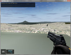
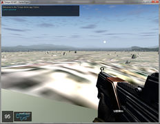
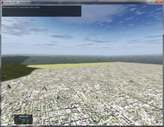
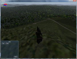
At present, only two types of data are transferred from FlightGear to the client game engine: skybox images and terrain data. A custom camera group has been created (skybox-cameras.xml) which creates a set of five images capable of being mapped to a skybox in the client (there is no bottom image at this time). Meanwhile, as the player moves around the world, the terrainPager class in T3D sends requests for terrain data, which are answered in FlightGear by the creation of binary float array files for heights and integer array files for texture reference. These are named with the protocol "hght.(coordinates).bin" and "text.(coordinates).bin" respectively.
The application is still under heavy development, but the current version uses a custom networking class called "dataSource", which is responsible for opening and maintaining the socket connection, and sending a basic packet of information, and "worldDataSource" which inherits dataSource and handles all the real work.
This structure is up for debate and it is very likely that it will be discarded in the future in favor of a more general networking base class, probably from SimGear.
(Apologies, but the rest of this page is a group of somewhat random quotes on this subject, mostly from myself, helpfully assembled by Hooray who also created this page. I will attempt to make this a more organized presentation of the project at some point in the future. In the meantime, check out the blog at [1].)
| My ultimate goal here is a real-world-terrain-based MMO game using Unity for the FPS engine and FlightGear as a backend Skybox (video games) |
Status
| my skybox is working pretty well now, and I have the FG textures also imported into my Unity terrain, so if I can find a quick way to determine which texture goes where in flightgear when I load a new terrain, I will be a big step forward in the process of replicating my FG experience on the Unity terrain.
— chriscalef (Sat Apr 13). Easy way to find texcoords or texture for given lat/long?.
(powered by Instant-Cquotes) |
| I'm in the process of retrofitting the above described prototype so as to allow it to save out an array of finished Unity terrains and skyboxes, using the data provided once by flightgear during development, and then page through this precompiled data at runtime. This way the end user never has to have flightgear or terragear installed, they just run the Unity game, and only the developer has to deal with the flightgear side of things.
— chriscalef (Fri Jul 26). Re: Reporting back on some LiDAR research....
(powered by Instant-Cquotes) |
| I'm still working on my "FlightGear World Server", and the current mission is to replace my (achingly slow) skybox generator. My previous method was to rotate the camera via PropertyTree changes, and save screenshots at each cardinal direction. I finally got through the literature on CameraGroups and Cameras, however, and managed to hook up a set of five cameras which simultaneously record all five desired directions, with the correct field of view.
— chriscalef (Mon May 20). Anybody got any handy OSG image manipulation tips?.
(powered by Instant-Cquotes) |
Gallery
Approach
| Note Also see: Howto:Make_full_spherical_panorama |
The skyboxes are currently handled on the FlightGear side by the use of a custom camera group, located in a file called skybox-cameras.xml. I haven't worked out the rest of my data pruning issues and hence have not uploaded anything to the fgdata side of my FlightGear repository for this project, but the skybox file is necessary to run the project. Here is the skybox-cameras.xml file:
<!--

************************************************************************
Definitions for four cameras, tracking three cardinal directions ESW (main
camera handles North) and then one for straight up.

************************************************************************
-->
<PropertyList>
<camera-group>

<window>
<name>FlightGear World Server</name>
<host-name type="string"/>
<display>0</display>
<screen>0</screen>
<width>4000</width>
<height>800</height>
<decoration type="bool">false</decoration>
</window>

<camera>
<window>
 <name>FlightGear World Server</name>
</window>

<viewport>
<x>0</x>
<y>0</y>
<width>800</width>
<height>800</height>
</viewport>

<view>
<heading-deg type="double">90.0</heading-deg>
</view>

<frustum>
<top>480</top>
<bottom>-480</bottom>
<left>-480</left>
<right>480</right>
<near>480</near>
<far>40000</far>
<fixed-near-far>true</fixed-near-far>
</frustum>
</camera>

<camera>
<window>
<name type="string">FlightGear World Server</name>
</window>

<viewport>
<x>800</x>
<y>0</y>
<width>800</width>
<height>800</height>
</viewport>

<view>
<heading-deg type="double">0</heading-deg>
</view>

<frustum>
<top>480</top>
<bottom>-480</bottom>
<left>-480</left>
<right>480</right>
<near>480</near>
<far>40000</far>
<fixed-near-far>true</fixed-near-far>
</frustum>
</camera>

<camera>
<window>
<name>FlightGear World Server</name>
</window>

<viewport>
<x>1600</x>
<y>0</y>
<width>800</width>
<height>800</height>
</viewport>
<view>
<heading-deg type="double">-90.0</heading-deg>
</view>
<frustum>
<top>480</top>
<bottom>-480</bottom>
<left>-480</left>
<right>480</right>
<near>480</near>
<far>40000</far>
<fixed-near-far>true</fixed-near-far>
</frustum>
</camera>

<camera>
<window>
<name>FlightGear World Server</name>
</window>

<viewport>
<x>2400</x>
<y>0</y>
<width>800</width>
<height>800</height>
</viewport>

<view>
<heading-deg type="double">-180.0</heading-deg>
</view>

<frustum>
<top>480</top>
<bottom>-480</bottom>
<left>-480</left>
<right>480</right>
<near>480</near>
<far>40000</far>
<fixed-near-far>true</fixed-near-far>
</frustum>
</camera>

<camera>
<window>
<name>FlightGear World Server</name>
</window>

<viewport>
<x>3200</x>
<y>0</y>
<width>800</width>
<height>800</height>
</viewport>
<view>

<heading-deg type="double">0.0</heading-deg>
<pitch-deg type="double">90.0</pitch-deg>
</view>
<frustum>
<top>480</top>
<bottom>-480</bottom>
<left>-480</left>
<right>480</right>
<near>480</near>
<far>40000</far>
<fixed-near-far>true</fixed-near-far>
</frustum>

</camera>

<gui>
<window>
<name type="string">FlightGear World Server</name>
</window>
</gui>
</camera-group>
</PropertyList>
Also, here is my preferences file, where the skybox-cameras file is included:
<!-- simply add an include directive referencing the skybox-cameras.xml file -->
<rendering include="skybox-cameras.xml">
| There may be some overlap when it comes to objects - I may end up converting some of the .ac files in flightgear into FBX or collada, so I can load them into Unity, but more often I think I'll be going the other way and adding my FBX game models into flightgear, ala this thread.
|
Implementation
Development
My suggestion would be to introduce 2-3 well-defined layers/components here:
- the screen shot/image handling stuff
- the IPC/RPC (networking) layer
- the skybox retrieval method (which could also be IPC based at some point).
Networking
Your current implementation looks like a telnet-like approach to me - so, you could just as well modify the existing built-in telnet protocol/daemon to add support for new "skybox" related commands there - I've added corresponding pointers to the article on doing just that. I did something pretty much like that a few years ago, and it was really dead-simple.
I am not saying that this is necessarily the way to keep this working - but for the sake of prototyping, I would definitely focus on extending the built-in telnet daemon/server first.
We already have an RPC mechanism built-on top of so called "fgcommands" - those can also be easily invoked via telnet. Which basically means that telnet can be used for arbitrary IPC, and fgcommands can be used for creating/extending functionality. Equally, we already have a httpd-based jpeg-server that serves screen shots using native OSG machinery.
In other words, your current approach could be easily simplified and generalized, so that it would also become more efficient/faster.
I would probably continue prototyping, but on top of the built-in telnet protocol. That will greatly simplify your code - once you need something more powerful, e.g. for also serving binary data (think image blobs), I would consider adding a custom I/O protocol. I can tell you exactly how to do that and also provide stubs to get you going quickly, including all the cmake magic to integrate things properly. But I would prefer using telnet for starters, to move away from your current hard-coded I/O approach.
There's cross-platform/multi-platform socket handling code in simgear for all the socket stuff you are doing there e.g. see SGSocket Internally, I/O protocols and network stuff usually live in $FG_SRC/Network Which is also where you can see, that there's the concept of an "FGIOChannel" for encapsulating all the logic you added to fg_init.cxx fg_init.cxx will only set up the IO channel, which just inherits from the corresponding interface class: http://api-docs.freeflightsim.org/simgear/classSGIOChannel.html
For examples, look at the httpd or telnet/props stuff
You will find that using these SimGear 2-3 APIs will greatly simplify and reduce your code, while making it much more straightforward to move it into a separate module, that also compiles across all platforms.
Equally, there's a ton of SGGeo* helpers available for doing all lat/lon computations that can dream of
Demo using Python
Using the Python code available at [2], the following snippet of code can be used to display a FlightGear-based SkyBox using Python:
