OpenRadar: Difference between revisions
Jump to navigation
Jump to search
(Hopefully someone will pick it up now ;)) |
m (update of project status) |
||
| Line 10: | Line 10: | ||
| os = | | os = | ||
| platform = | | platform = | ||
| developmentstatus = | | developmentstatus = Active | ||
| type = | | type = | ||
| license = | | license = | ||
| Line 18: | Line 18: | ||
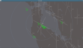
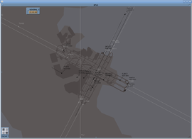
'''OpenRadar''' is a standalone radar screen which connects to the [[FlightGear]] [[Howto: Multiplayer|multiplayer]] servers. Coastlines, lakes, airfield layouts and airspaces (at least the 2D part) are being read from shapefiles. | '''OpenRadar''' is a standalone radar screen which connects to the [[FlightGear]] [[Howto: Multiplayer|multiplayer]] servers. Coastlines, lakes, airfield layouts and airspaces (at least the 2D part) are being read from shapefiles. | ||
As of December 2010 development has restarted, no development had been undertaken since 2008. This page will be updated shortly. | |||
[[Category:Java]] | [[Category:Java]] | ||
Revision as of 16:19, 9 December 2010
 San Francisco bay area | |
| Developed by | Ralf Gerlich |
|---|---|
| Written in | Java |
| Development status | Active |
| Website | |
OpenRadar is a standalone radar screen which connects to the FlightGear multiplayer servers. Coastlines, lakes, airfield layouts and airspaces (at least the 2D part) are being read from shapefiles.
As of December 2010 development has restarted, no development had been undertaken since 2008. This page will be updated shortly.
