OpenRadar: Difference between revisions
Jump to navigation
Jump to search
(Beta anouncement) |
|||
| Line 22: | Line 22: | ||
It supports Multiplayer Chat and multiple FGCom frequencies. | It supports Multiplayer Chat and multiple FGCom frequencies. | ||
'' | ''BETA is available! Updated 12th of January''. | ||
Please read the [[OpenRadarGuide| Guide to OpenRadar]]! | |||
== Main Features == | == Main Features == | ||
| Line 56: | Line 56: | ||
== Current state == | == Current state == | ||
Release 1 is | Beta for Release 1 is available. | ||
'''Please update!''' | |||
[[OpenRadarDownload| binary release updated 2013-01-12]] | |||
[[OpenRadarDownload| binary release updated 2013-01- | |||
== System requirements == | == System requirements == | ||
OpenRadar is no application for a small, a weak computer without graphic | OpenRadar is no application for a small, a weak computer without graphic acceleration. We need to handle a lot of data, perform permanent Geo to Map projections and display them on the screen, while you | ||
are shifting the map. | are shifting the map. | ||
And believe me, a small screen is bad for the eyes and your neck muscles :-) | And believe me, a small screen is bad for the eyes and your neck muscles :-) | ||
Revision as of 07:20, 12 January 2013
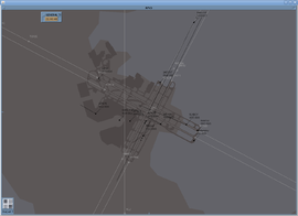
 Oakland international | |
| Developed by |
Ralf Gerlich, Wolfram Wagner |
|---|---|
| Written in | Java |
| Development status | active |
| Website | |


San Francisco International Airport(historical)
OpenRadar is a standalone radar screen which connects to the FlightGear multiplayer servers. Coastlines, lakes, airfield layouts and airspaces (at least the 2D part) are being read from shapefiles. It supports Multiplayer Chat and multiple FGCom frequencies.
BETA is available! Updated 12th of January.
Please read the Guide to OpenRadar!
Main Features
- Radar:
- Display of radar contacts
- Highlighting of the selected contact, controlled and interesting contacts
- Contacts can be neglected
- Display of radar contact base data on screen
- Airports including runway numbers, alignment lines, extended center lines, vectoring help and baselines
- Navaids (FIX, NDB, VOR) toggle
- Distance circles around airport
- Ground net including parking positions
- Free definable zoom levels (Ground, Tower, App, Sector), mouse wheel works additional (zoom level and centers is saved)
- Zoom depending detail visibility (runway numbers close to ground, airways visible from further away)
- Multiplayer Chat
- Filter on selection and visibility
- Automated multilanguage text handling like ATC-ML (The same texts are available, Live data is included into messages): Click on flight strip, choose message, add details and send the message in English and in one additional language, defined on per contact base
- FGCom Integration (multiple radios in parallel), PTT Button, FGCom started by OpenRadar in background
- Weather (Metar) Download and display (wind, air pressure, visibility)
- Runway display is using Metar information (magn. heading,length, width, cross wind stength, ILS frequency)
- Compensation of wind and magnetic declination
- Radar contacts displayed on Flight Strips
- Flight Strips can be ordered manual in sequence and arranged in list (3 columns)
- Automatic ordering available
- Comment editor to make notes on Flight Strips
- SetupDialog
- Search airports
- Download new airport shape files from scenery database
- Edit settings
Current state
Beta for Release 1 is available.
Please update!
binary release updated 2013-01-12
System requirements
OpenRadar is no application for a small, a weak computer without graphic acceleration. We need to handle a lot of data, perform permanent Geo to Map projections and display them on the screen, while you are shifting the map. And believe me, a small screen is bad for the eyes and your neck muscles :-)
- a screen wide enough to display everything (22 can show about 20 radar contacts, with two radios and two runways active, if you control a small airport with less runways, 18 should be minimum)
- a Java Runtime Environment 1.7.0 e.g. OpenJDK
- FGCom recommended
- a rather good network connection (FGCom is a VoIP application and FG transmits data as UDP packages, they can get lost over a weak connection)
Related content
- A guide to OpenRadar
- I want to try it!
- Change Log
- FAQ / Known Issues
- Please add your feature proposals to this page!