File:Terrain loading2b.png
Jump to navigation
Jump to search

Size of this preview: 800 × 430 pixels. Other resolution: 1,920 × 1,032 pixels.
Original file (1,920 × 1,032 pixels, file size: 1.18 MB, MIME type: image/png)
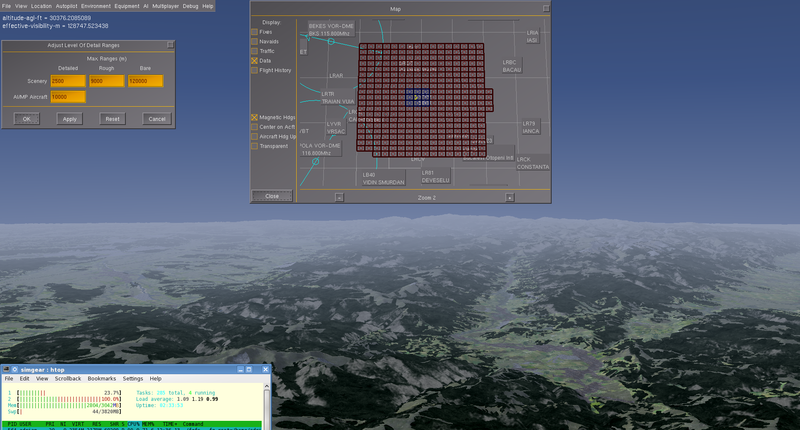
Visibility 80 miles, LOD distance bare 120 km, memory consumption 2800 MB, 680 of which are other applications. Map shows extent of tiles loaded around the Aircraft. At 10000 meters, FPS was 21.
File history
Click on a date/time to view the file as it appeared at that time.
| Date/Time | Thumbnail | Dimensions | User | Comment | |
|---|---|---|---|---|---|
| current | 03:48, 16 December 2012 | | 1,920 × 1,032 (1.18 MB) | Adrian (talk | contribs) | Visibility 80 miles, LOD distance bare 120 km, memory consumption 2800 MB, 680 of which are other applications. Map shows extent of tiles loaded around the Aircraft. At 10000 meters, FPS was 21. |
You cannot overwrite this file.
File usage
There are no pages that use this file.