File:StuartsSlippyMap1.png
Jump to navigation
Jump to search

No higher resolution available.
StuartsSlippyMap1.png (750 × 494 pixels, file size: 293 KB, MIME type: image/png)
Summary
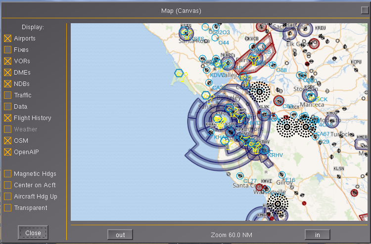
| Description | (en) pushed some changes to fgdata with OpenStreetMap, OpenAIP and VFRMap layers for the Canvas Map Layer system, which can be seen on the canvas map dialog. They use a generic Slippy Map OverlayLayer Map Layer. Additional web-based mapping can be trivially added by creating a new lcontroller. See Nasal/Canvas/map/OpenAIP.lcontroller for an example.
I've also added a Web Mercator Projection to the Canvas Map support. The wiki will be updated shortly.[1] |
| Date | 1 October 2017 |
| Source | Own work |
| Author | Hooray |
Licensing
|
- ↑ stuart (Sep 28th, 2017). Re: Canvas G1000 .
File history
Click on a date/time to view the file as it appeared at that time.
| Date/Time | Thumbnail | Dimensions | User | Comment | |
|---|---|---|---|---|---|
| current | 17:48, 1 October 2017 | | 750 × 494 (293 KB) | Hooray (talk | contribs) | User created page with UploadWizard |
You cannot overwrite this file.
File usage
The following 4 pages use this file: