Template:POTW/2009-46

From FlightGear wiki
< Template:POTW
Revision as of 21:11, 8 November 2009 by Gijs (talk | contribs) (Created page with '{| class="prettytable" style="background-color:#efefef; width: 100%;" | align="center" |300px |- | align="left" | Using free software, like QGIS, you are…')
(diff) ← Older revision | Latest revision (diff) | Newer revision → (diff)
Jump to navigation Jump to search
Capture-17.png
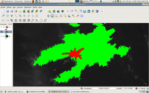
Using free software, like QGIS, you are able to edit the FlightGear scenery terrain. Handdrawn areas have a huge improvement in the level of detail and accuracy over the default terrain. When flying, the difference is huge. Moreover, this enables the autogeneration of cities, trees, and so on.