OpenRadar
Jump to navigation
Jump to search
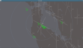
 San Francisco bay area | |
| Developed by |
Ralf Gerlich, Wolfram Wagner |
|---|---|
| Written in | Java |
| Development status | active |
| Website | |
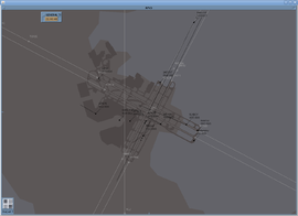
OpenRadar is a standalone radar screen which connects to the FlightGear multiplayer servers. Coastlines, lakes, airfield layouts and airspaces (at least the 2D part) are being read from shapefiles.
Development has been resumed.
First target is a usable, ergonomic prototype for FlightGear ATCs.
Features:
- Radar:
- Display of radar contacts
- Highlighting of the selected contact
- Display of radar contact base data on screen
- Airports including runway numbers, alignment lines, ILS cones
- Navaids
- Free definable zoom levels (Ground, Close, Sector), mouse wheel works additional
- Zoom depending detail visibility (runway numbers close to ground, airways visible from further away)
- Multiplayer Chat
- Highlighting of messages received by selected contact
- Filter on selection, frequency and visibility
- FGCom Integration (multiple radios in parallel), PTT Button, FGCom started by OpenRadar in background
- Weather (Metar) Download and display (wind, air pressure, visibility)
- Runway display using Metar information (true heading,length, width, shear wind stength, relative wind direction,ILS frequency)
- Radar contacts displayed on Flight Strips
- Flight Strips can be ordered in sequence and arranged in list (3 columns)
- Comment editor to make notes on Flight Strips (2 short lines, more stay visible via editor)
- Filter for radar contacts on flight state (Ground, Starting, Landing, Traveling...)
Current state: Prototype contains most of these features. Before release, it is planned to add a startup dialog to select the airport and configure the basics like the radios...
Prototype release planned before Christmas 2012.
