JMapView: Difference between revisions
Jump to navigation
Jump to search
(→Help: Java is needed) |
m (Mark as abandoned) |
||
| Line 1: | Line 1: | ||
{{Obsolete|Phi}} | |||
{{Infobox Software | {{Infobox Software | ||
| title = JMapView | | title = JMapView | ||
| Line 8: | Line 10: | ||
| writtenin = Java | | writtenin = Java | ||
| os = OS Independent | | os = OS Independent | ||
| developmentstatus = | | developmentstatus = Abandoned (2013) | ||
| license = [[GNU General Public License]]. | | license = [[GNU General Public License]]. | ||
| website = http://jmapview.sourceforge.net/ | | website = http://jmapview.sourceforge.net/ | ||
Latest revision as of 00:35, 30 August 2020
| This article or section contains obsolete information.
Please refer to Phi instead. |
 | |
| Initial release | 0.3 (March 19, 2009) |
|---|---|
| Latest release | 0.3 (March 19, 2009) |
| Written in | Java |
| OS | OS Independent |
| Development status | Abandoned (2013) |
| License | GNU General Public License. |
| Website | |
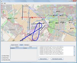
JMapView is a mapping application for FlightGear, similar to Atlas.
Help
- Install JMapView as described at the projects website.
- Install a Java interpreter if you don't have one.
- Run it, as described.
- Run FlightGear with the following command:
--nmea=socket,out,20,localhost,5500,udp
This can be optionally set through the Advanced > Input/Output dialog of FGRun or by using the Atlas fields at the last page of FGRun (fill them with localhost and 5500).