File:TerraGear build server concept map.png
Jump to navigation
Jump to search
No higher resolution available.
TerraGear_build_server_concept_map.png (620 × 330 pixels, file size: 10 KB, MIME type: image/png)
Summary
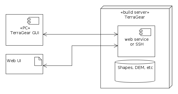
| Description | (en) Schematic of a possible setup for TG GUI or a web interface to access TerraGear services provided by a build server |
| Date | 15 February 2014 , 22:53:57 |
| Source | Own work |
| Author | reeed |
|
Location on Earth |
|
View this and other nearby images on: Google Maps - Google Earth OpenStreetMap | (Info) |
|---|
Licensing
|
File history
Click on a date/time to view the file as it appeared at that time.
| Date/Time | Thumbnail | Dimensions | User | Comment | |
|---|---|---|---|---|---|
| current | 14:56, 15 February 2014 | | 620 × 330 (10 KB) | Reeed (talk | contribs) | User created page with UploadWizard |
You cannot overwrite this file.
File usage
The following 2 pages use this file: