File:Samedan osm2city landuse generated plan view.png: Difference between revisions
Jump to navigation
Jump to search
(User created page with UploadWizard) |
|||
| Line 1: | Line 1: | ||
=={{int:filedesc}}== | =={{int:filedesc}}== | ||
{{Information | {{Information | ||
|description={{en|1=Yellow footprints of buildings generated by osm2city landuse based on OpenStreetMap data.}} | |description={{en|1=Yellow footprints of buildings generated by osm2city landuse based on OpenStreetMap data. Red areas is artificial land-use, where there is a group of buildings but without related OSM land-use}} | ||
|date=2015-01-04 20:29:35 | |date=2015-01-04 20:29:35 | ||
|source={{own}} | |source={{own}} | ||
Latest revision as of 19:52, 4 January 2015
Summary
| Description | (en) Yellow footprints of buildings generated by osm2city landuse based on OpenStreetMap data. Red areas is artificial land-use, where there is a group of buildings but without related OSM land-use |
| Date | 4 January 2015 , 20:29:35 |
| Source | Own work |
| Author | Vanosten |
Licensing
|
File history
Click on a date/time to view the file as it appeared at that time.
| Date/Time | Thumbnail | Dimensions | User | Comment | |
|---|---|---|---|---|---|
| current | 19:36, 4 January 2015 | 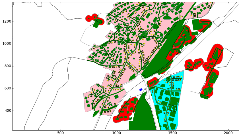 | 840 × 480 (258 KB) | Vanosten (talk | contribs) | User created page with UploadWizard |
You cannot overwrite this file.
File usage
There are no pages that use this file.