File:Combat Mission Plotter PLU-6C.png: Difference between revisions
No edit summary |
(→{{int:filedesc}}: +cat) |
||
| Line 4: | Line 4: | ||
It contains a protractor, time-minute scales used for adding marks every minute along the track, time-in-turn scales for doing the same in turns at various bank angles and air speeds, a nautical mile scale for distances, a 1000 meter grid for plotting exact coordinates on a 1:250 000 scale map and some figures used for various annotations on the map. | It it is intended to be used with maps in the scales 1:500,000 and 1:250,000 and contains a protractor, time-minute scales used for adding marks every minute along the track, time-in-turn scales for doing the same in turns at various bank angles and air speeds, a nautical mile scale for distances, a 1000 meter grid for plotting exact coordinates on a 1:250 000 scale map and some figures used for various annotations on the map. | ||
| Line 15: | Line 15: | ||
|author=[[User:Johan G|Johan G]] | |author=[[User:Johan G|Johan G]] | ||
|permission= | |permission= | ||
|other_versions= | |other_versions=Rendered from the same SVG file as [http://commons.wikimedia.org/wiki/File:Combat_Mission_Plotter_PLU-6C.svg File:Combat Mission Plotter PLU-6C.svg] on Wikimedia Commons. | ||
|other_fields= | |other_fields= | ||
}} | }} | ||
[[Category:Maps]] | |||
=={{int:license-header}}== | =={{int:license-header}}== | ||
{{self|cc-zero}} | {{self|cc-zero}} | ||
Revision as of 09:53, 16 May 2013
Summary
| Description | (en) The combat mission plotter PLU-6/C as per MIL-P-87133 (2 May 1978) is a plotter that is used while planning low-level flights.
|
| Date | 16 May 2013 |
| Source | Own work |
| Author | Johan G |
| Other versions |
Rendered from the same SVG file as File:Combat Mission Plotter PLU-6C.svg on Wikimedia Commons. |
Licensing
|
File history
Click on a date/time to view the file as it appeared at that time.
| Date/Time | Thumbnail | Dimensions | User | Comment | |
|---|---|---|---|---|---|
| current | 09:49, 16 May 2013 | 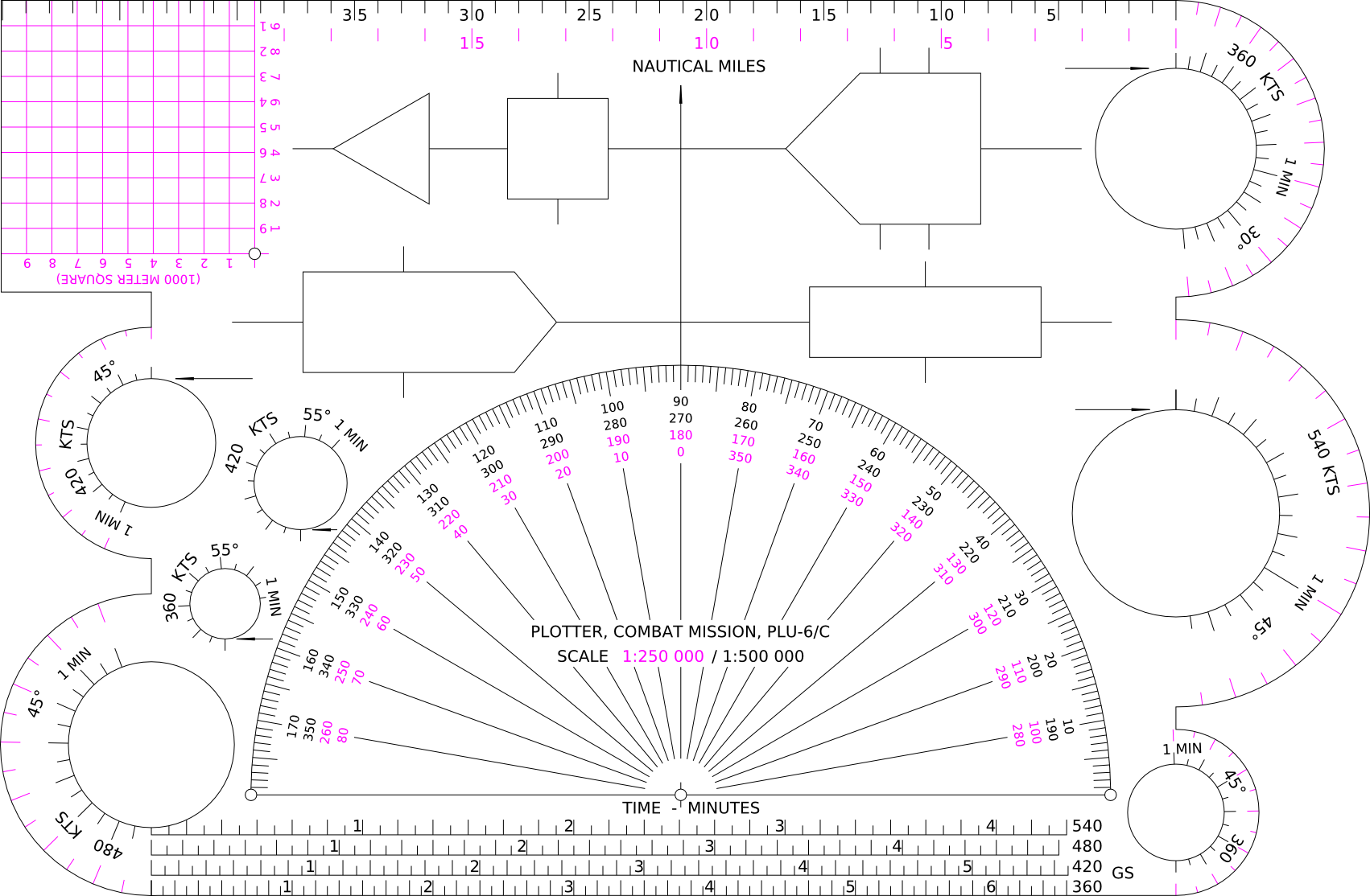 | 1,702 × 1,114 (255 KB) | Johan G (talk | contribs) |
You cannot overwrite this file.
File usage
There are no pages that use this file.