Canvas EFB framework
| This article is a stub. You can help the wiki by expanding it. |
|
Note:
While this article is based on considerable community feedback, there's nobody working on this currently.
Mentors: Hyde[3], Hooray (get in touch to learn more) |
 | |
| Started in | not yet... |
|---|---|
| Description | EFB Framework |
| Contributor(s) | I-NEMO, Hyde, Hooray |
| Status | discussion |
| Subforum | http://forum.flightgear.org/viewforum.php?f=71 |
| The FlightGear forum has a subforum related to: Canvas |
Background
| I'm trying to change 777's indicators to canvas system now.
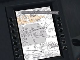
Could someone lecture me how to display Airport Chart - Aircraft/Instruments/Textures/od_groundradar.rgb - on EFB?
Or is there any other equivalent method?
— Hyde (Tue Oct 22). How to display Airport Chart?.
|
| Feel free to work on the EFB (don't have that in the 744), but please don't waste any time on the rest of the displays. I already have PFD and ND for the 744 and am making them as generic as possible. They will end up in Instruments/ so we can re-use them on other aircraft.
— Gijs (Tue Oct 22). Re: How to display Airport Chart?.
|
| I'm quite busy with modeling a new EFB and other stuff.
— I-NEMO (Wed Apr 30). Re: New Boeing 777 Seattle download site (git).
|
| we are working on the new EFB, which is coming out nicely, we presume.
— I-NEMO (Tue May 13). Re: New Boeing 777 Seattle download site (git).
|
| I'm currently developing a new EFB for the 777 Seattle; even if I'm inspiring to Omega95's job made for the 787 Dreamliner (which, BTW, I'm not able to load onto FG 3.0!...a mystery!), I'm working on it since more than a month (everyday, several hours), the task is a long one. I do hope to be able to have a "rude" version of the new EFB (with some simplifications and enhancements, looking to Boeing's 777 EFB Manuals) to submit to my partners in about ten days (I'm totally a newbie on nasal! [Ouch! ]...but I'm trying to learn).
Then, we will go through our internal testing and improvement.
Then, again, the new EFB will be released 'as-is', so the FG Pilots might play with it and report back to us what's wrong, and what might be improved.
— I-NEMO (Tue May 06). Re: New Boeing 777 Seattle download site (git).
|
| we may not even need to run external EFB software, because our integrated scripting system in combination with the Canvas 2D rendering system may provide all the hooks required to render such geo-referenced imagery directly inside FlightGear with very little work needed - we even have http bindings to load images on the fly.
— Hooray (Sun Apr 20). Re: A project to create a source of free geo-referenced inst.
|
| we should have most building blocks required for this in place, maybe some things are not yet exposed to scripting space currently (but still available in C++) - but being able to run this directly inside FG would be kinda useful obviously, especially because of recent work in this area, especially the tiled map support, HTTP bindings, SGPath exposure (disk access). And being able to directly geo-align raster images has been previously discussed, too
— Hooray (Mon Apr 21). Re: A project to create a source of free geo-referenced inst.
|
| Right now the script basically just a creates .PNG and a .VRT for a given plate, suitable for loading directly into something like QGIS
If you run the script for the entire set of plates (eg. "multithread.sh .") using the -s option you'll get a statistics file which has all of the lon/lat extents for each plate in it (which is how I made the spreadsheet I linked here)
— jlmcgraw (Mon Apr 21). Re: A project to create a source of free geo-referenced inst.
|
| extending our 2D rendering API (Canvas) to provide a mechanism to geo-align such images would be kinda useful for a variety of purposes, we already have a "map" element that can automatically geo-reference lat/lon pairs without any manual work involved - and we also have support for a raster image element.
— Hooray (Mon Apr 21). Re: A project to create a source of free geo-referenced inst.
|
| all we have to do to display such charts within FlightGear is to load the chart image and apply the matrix created by the script. In the case of VRT files, it should be enough to just read the GeoTransform tag and set it as matrix on the Image element inside the canvas (with the parent element set up to have a coordinate system matching the current position and range).
Some central server for collecting such free and geo-referenced charts would surely be useful and probably does not require too much space and bandwith. These charts would not only be useful for FlightGear, but also for real aviation applications, like EFBs. I think I saw this or a similar script somewhere inside the sources of Avare?
— TheTom (Wed Apr 23). Re: A project to create a source of free geo-referenced inst.
|
| having just a web service that maintains and provides those charts would be straightforward and should not require any work on the Canvas side of things, also it avoids redundant work, because charts would remain identical normally, i.e. would only need to be created once. Not sure what the geo-coding question was all about ..
— Hooray (Wed Apr 23). Re: A project to create a source of free geo-referenced inst.
|


Design
rgb files are conventional images, like jpg/png - so they are so called "raster images" (unlike SVGs, which are "vector images"). So to display raster images, you can use the tutorial at: http://wiki.flightgear.org/Howto:Using_raster_images_and_nested_canvases This assumes that you have previously created the corresponding charts as image files, a technique that omega95 and redneck have been using for a while.
For starters, you can use the Nasal console to play around with it: http://wiki.flightgear.org/Nasal_Console
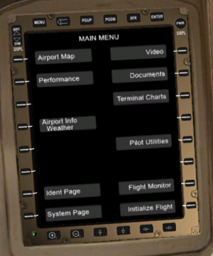
Now, to add an EFB dialog to the 777, you could use the old dialogs and embed a canvas region, see the tutorial at: http://wiki.flightgear.org/Howto:Adding_a_canvas_to_a_GUI_dialog
If you want to display vector images (SVG) or custom-drawn maps, you'll want to use OpenVG paths
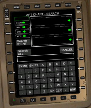
To display a procedurally-created airport chart (without adding a precreated raster image for each airport), you'll probably want to use the technique used by the airport selection dialog