Airport Diagram Generator: Difference between revisions
Jump to navigation
Jump to search
No edit summary |
No edit summary |
||
| Line 22: | Line 22: | ||
# Start the application in graphical mode: | # Start the application in graphical mode: | ||
#* <tt>java -jar AirportPainter.jar</tt> | #* <tt>java -jar AirportPainter.jar</tt> | ||
==Contributors== | |||
* brisa: Main program | |||
* Jentron: svgs for vor, tacan etc..... | |||
==External links== | ==External links== | ||
* [http://flightgear.org/forums/viewtopic.php?f=6&t=5377 Forum-topic] including download links | * [http://flightgear.org/forums/viewtopic.php?f=6&t=5377 Forum-topic] including download links | ||
Revision as of 15:42, 16 October 2009
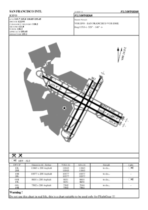
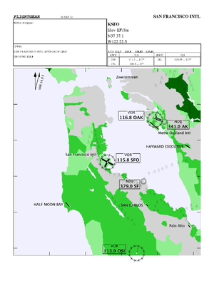
The Airport Diagram Generator is a Java application capable of generating airport diagrams using FlightGear data only.
Generated diagrams contain:
- Airport ID and name
- A schematic view of the airport layout (run- and taxiways).
- All frequencies regarding the airport (ILS, Tower, Gnd, Atis etc.).
- Nearest Navaid information and heading to/from.
- True and magnetic compass indication.
- Runway(s) length(s).
The software is based upon the Kelpie Flight Planner code.
Help
You can:
- Generate a single airport diagram:
- java -jar AirportPainter.jar -fg-root=/path/to/your/fgfs/data -airport=KSFO
- Generate multiple airport diagrams within an area:
- java -jar AirportPainter.jar -fg-root=/path/to/your/fgfs/data -range=20 -airport=KSFO
- Start the application in graphical mode:
- java -jar AirportPainter.jar
Contributors
- brisa: Main program
- Jentron: svgs for vor, tacan etc.....
External links
- Forum-topic including download links

