File:VOR route.png
Jump to navigation
Jump to search

No higher resolution available.
VOR_route.png (600 × 600 pixels, file size: 106 KB, MIME type: image/png)
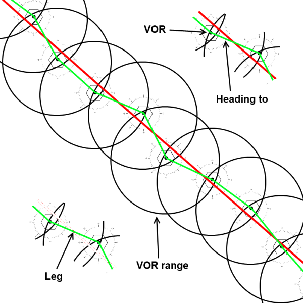
Red = straight line between take-off and landing Green= individual legs Compass rose= record heading of TO Circle= range of VOR station Hexagon = VOR station
File history
Click on a date/time to view the file as it appeared at that time.
| Date/Time | Thumbnail | Dimensions | User | Comment | |
|---|---|---|---|---|---|
| current | 08:56, 14 September 2011 | | 600 × 600 (106 KB) | PH-JBO (talk | contribs) | Red = straight line between take-off and landing Green= individual legs Compass rose= record heading of TO Circle= range of VOR station Hexagon = VOR station |
You cannot overwrite this file.
File usage
The following 2 pages use this file: