File:Mount Everest VNTR.jpg
Jump to navigation
Jump to search

Size of this preview: 800 × 342 pixels. Other resolution: 900 × 385 pixels.
Original file (900 × 385 pixels, file size: 79 KB, MIME type: image/jpeg)
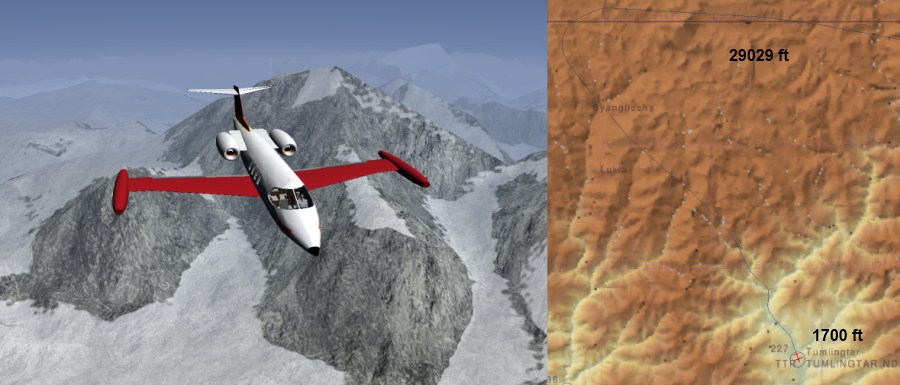
Learjet 35-A and Mount Everest viewed from West towards East. Atlas image of the route to VNTR. I could see the direction of NDB and knew the altitude of the RW. The RW was not visible till the absolute last moment racing down with airbrakes at max. The landing was a success but I had to change underwear and clear the seat.
File history
Click on a date/time to view the file as it appeared at that time.
| Date/Time | Thumbnail | Dimensions | User | Comment | |
|---|---|---|---|---|---|
| current | 09:57, 10 September 2011 | | 900 × 385 (79 KB) | PH-JBO (talk | contribs) | Passing Mount Everest and route to landing at VNTR |
You cannot overwrite this file.
File usage
There are no pages that use this file.