File:Map2.png
Jump to navigation
Jump to search
Size of this preview: 577 × 599 pixels. Other resolution: 708 × 735 pixels.
Original file (708 × 735 pixels, file size: 123 KB, MIME type: image/png)
Summary
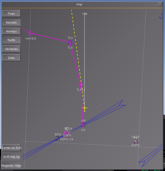
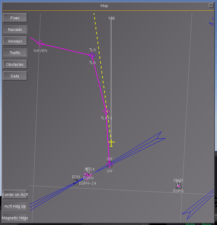
| Description | (en) Aircraft heading up, with GPS track shown as a dashed yellow line (with a 40kt head/cross wind). |
| Date | |
| Source | |
| Author |
File history
Click on a date/time to view the file as it appeared at that time.
| Date/Time | Thumbnail | Dimensions | User | Comment | |
|---|---|---|---|---|---|
| current | 14:17, 18 March 2010 | | 708 × 735 (123 KB) | Zakalawe (talk | contribs) |
You cannot overwrite this file.
File usage
The following page uses this file: