Summary
| Description |
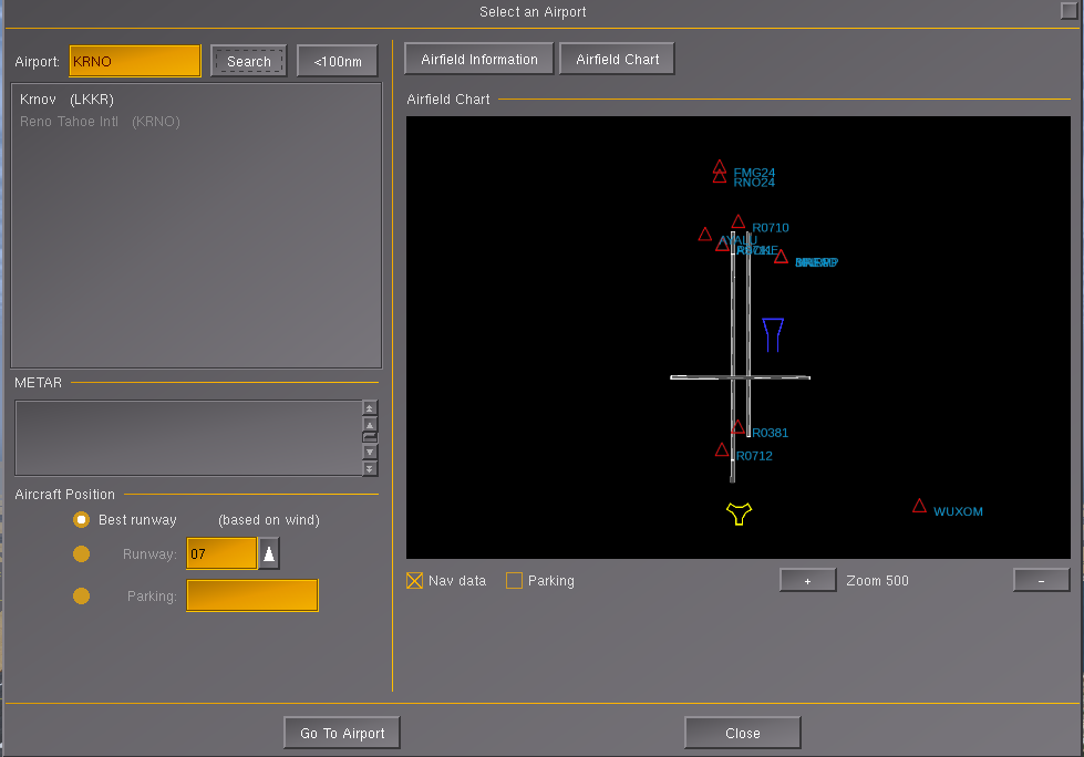
(en) Screenshot showing a the PUI based airports.xml dialog with an embedded Canvas widget feature a MapStructure based airport diagram developed by Stuart |
| Date |
13 October 2017
(2017-10-13) |
| Source |
Own work |
| Author |
Hooray |
Licensing
I, the copyright holder of this work, hereby publish it under the following license:

 
|
This file is licensed under the Creative Commons Attribution-Share Alike 4.0 International license.
You are free:
- to share – to copy, distribute and transmit the work
- to remix – to adapt the work
Under the following conditions:
- attribution – You must attribute the work in the manner specified by the author or licensor (but not in any way that suggests that they endorse you or your use of the work).
- share alike – If you alter, transform, or build upon this work, you may distribute the resulting work only under the same or similar license to this one.
|
|
|
|
|
File history
Click on a date/time to view the file as it appeared at that time.
| Date/Time | Thumbnail | Dimensions | User | Comment |
|---|
| current | 17:54, 13 October 2017 |  | 979 × 684 (58 KB) | Hooray (talk | contribs) | User created page with UploadWizard |
You cannot overwrite this file.
File usage
The following 3 pages use this file:
